Project Seafloor, A Diving for Data Initiative

Program Mission
Project Seafloor is a comprehensive underwater research and community engagement program designed to explore, document, and protect the hidden ecosystems that define Florida’s coastal waters.
Through structured data collection dives, youth education, and inclusive participation from both able-bodied and mobility-impaired volunteers, Project Seafloor brings science, stewardship, and community together to restore and protect Sarasota Bay and surrounding estuaries.
Our mission is to:
Collect and analyze underwater data to guide restoration and conservation.
Engage youth and the public in marine science and environmental protection.
Create inclusive opportunities for all individuals to contribute to ocean conservation.
Use scientific data to drive policy, restoration, and habitat action, including clam restoration, debris mitigation, and artificial reef development.
Program Overview
Project Seafloor functions as both a data acquisition platform and a community science hub, integrating advanced technology, local expertise, and educational opportunity.
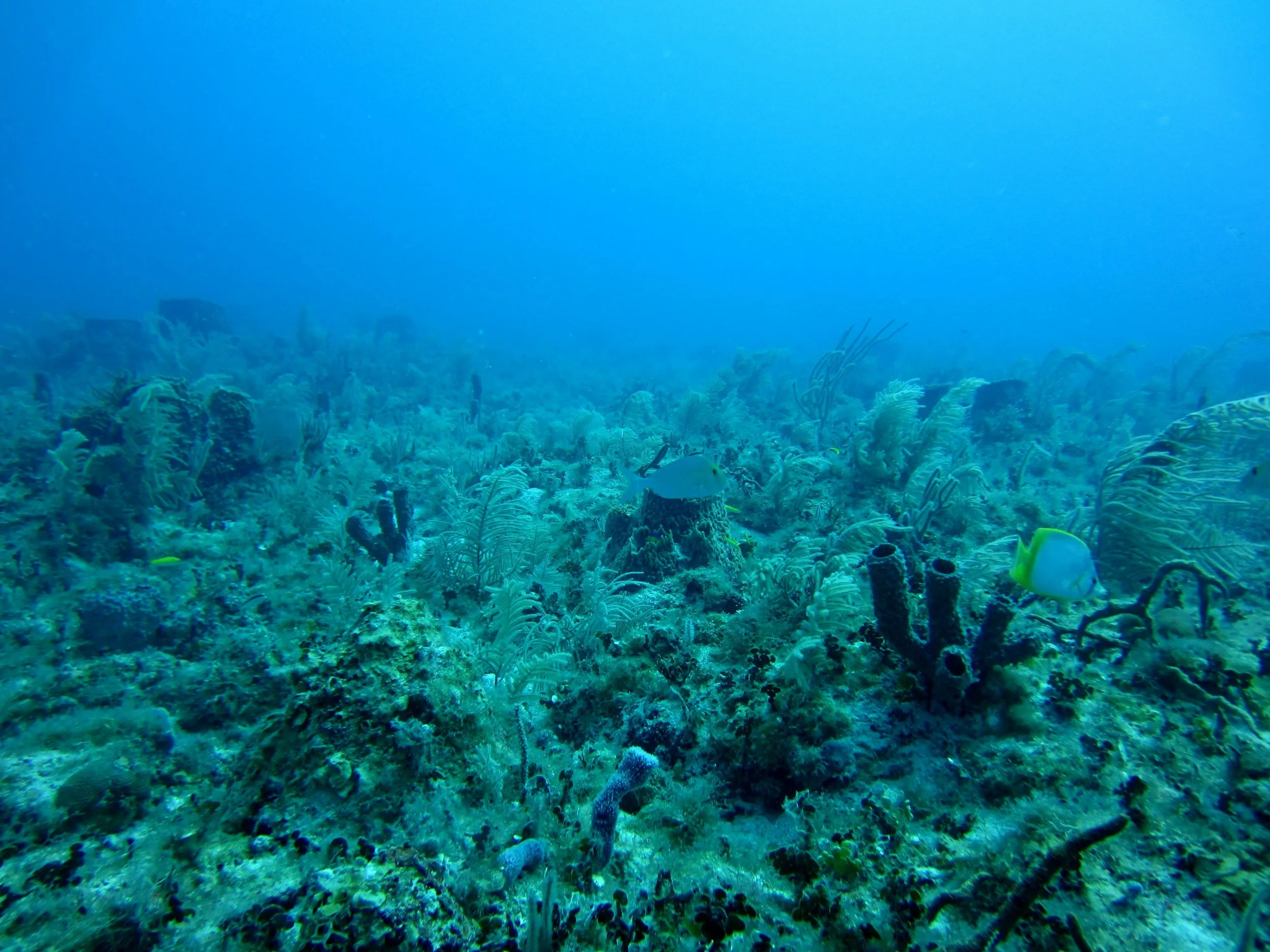
Teams of trained divers, marine biologists, and volunteers conduct underwater surveys across Sarasota Bay and surrounding Gulf waters to gather data on:
Seagrass coverage and density
Benthic fauna such as clams, crustaceans, and invertebrates
Fish and ray populations and their interactions with seagrass habitats
Water quality, sediment composition, and pollution presence
Marine debris accumulation and types
Existing artificial reef conditions and biological activity
This information is archived into a growing spatial database — a living map of bay health — which guides future restoration actions and provides evidence-based recommendations to regional agencies and conservation partners.
Program Structure
1. Marine Data & Research Division
Responsible for all underwater survey operations and scientific data collection.
This division conducts fieldwork using scuba, snorkel, and remote observation (ROV, sonar, and GPS-based mapping).
Data includes biological diversity indexes, seagrass and sediment assessments, and habitat classification.
Outputs:
Long-term habitat maps of seagrass beds and shellfish zones.
Data reports suitable for submission to regulatory bodies such as FWC for clam deployment or marine restoration permitting.
Collaboration-ready datasets for local universities and environmental agencies.
Pollution & Debris Response Unit
Focuses on the identification, classification, and prioritization of underwater debris and pollution.
Using GPS-referenced imaging and diver reports, this division compiles debris maps to target cleanup operations.
Outputs:
Underwater debris heat maps and removal schedules.
Documentation for grant and agency reporting to demonstrate environmental impact.
Integration with local cleanup partners for coordinated removal events.
3. Artificial Reef Monitoring & Fisheries Enhancement Division
This division monitors existing artificial reef structures and natural hard-bottom habitats to track fish aggregation, biodiversity, and habitat complexity.
Purpose:
Provide scientific validation of reef performance and habitat value.
Support applications for new artificial reef deployments by demonstrating ecological benefits such as species density, juvenile recruitment, and sediment stabilization.
Outputs:
Photo and video documentation for public education and scientific analysis.
Longitudinal data showing species recovery and seagrass interaction around reef structures.
4. Youth Science Corps
Provides training, mentorship, and field experience for high school and college students pursuing marine science, environmental policy, or biology.
Key Functions:
Hands-on participation in seagrass monitoring, GPS mapping, and biodiversity indexing.
Workshops on marine ecosystems, conservation ethics, and scientific methodology.
Leadership roles in organizing educational outreach and school partnerships.
Outcomes:
Creates a pathway from youth involvement to environmental career opportunities.
Builds community pride and future generations of marine scientists.
5. Adaptive Access & Inclusion Program
Ensures that mobility-impaired individuals can meaningfully participate in marine conservation.
Key Methods:
Onboard sonar analysis, drone monitoring, and digital data entry.
Development of adaptive diving and vessel systems for safe participation.
Remote data interpretation for participants unable to dive physically.
Goal:
To make marine conservation fully inclusive, demonstrating that passion for ocean health transcends physical limitation.
6. Community & Partnership Engagement Wing
Acts as the communication and collaboration arm of Project Seafloor.
Responsibilities:
Coordinate partnerships with Sarasota Bay Watch, FWC, New College, local universities, NOAA programs, and community groups.
Organize bay events, citizen science days, and public exhibits of project findings.
Disseminate results through digital dashboards, public reports, and media campaigns to promote awareness and transparency.
7. Technology & Innovation Division
Manages equipment and develops tools to enhance underwater data collection.
This includes GPS-integrated cameras, hydroacoustic mapping, and environmental sondes.
Goals:
Streamline data workflow from dive to cloud-based storage.
Innovate cost-effective technology that can be replicated by other bay systems statewide.
Data Utilization Pathways
Collected data from Project Seafloor will directly feed into actionable restoration and conservation strategies:
FWC Clam Restoration Applications:
Data from sediment and seagrass surveys will determine optimal substrate and water-quality conditions for clam deployment, strengthening applications with empirical site data.Debris Cleanup Planning:
GPS-tagged debris surveys will identify pollution hotspots, enabling targeted removal efforts and volunteer coordination through The PET Method’s logistics teams.Artificial Reef Monitoring:
Species abundance and biodiversity data will be used to evaluate reef health, attract fisheries funding, and demonstrate the ecological necessity of new reef installations.Long-Term Environmental Benchmarking:
Data collected annually will build a time-series record to evaluate bay health trends, support grant applications, and provide public accountability for restoration outcomes.
Community Impact and Education
Project Seafloor is more than a science program — it is a platform for community empowerment.
By uniting professional divers, students, scientists, and citizens, we foster collaboration between human potential and the marine environment.
Every participant becomes part of a legacy project — one that restores not only the health of Sarasota Bay but also the connection between people and the living seafloor that sustains them.
Conclusion
Project Seafloor: A Diving for Data Initiative represents a transformative step forward in community-based marine research.
By combining scientific rigor, education, inclusivity, and hands-on restoration, The PET Method Inc. is setting a new standard for how local conservation can drive measurable environmental outcomes.
From seagrass surveys to clam restoration, from debris mapping to artificial reef validation — Project Seafloor turns data into action and discovery into stewardship.